 THE MOUNTAINS SURROUNDING OSPTHE MOUNTAINS SURROUNDING OSP
Much earlier in Oregon's history, somewhere in the general vicinity of Spanish Peak, the infamous Chief Paulina was shot dead by a rancher in 1867, finally ending decades of depredations upon the hated white invaders.....I'm excited about the viewing potential of Spanish Peak. Close examination of topographic maps of its summit ridge area shows both water (springs) and several potentially fine viewing sites for some high altitude astronomy (at 6500-6881 feet, depending on the exact site). And the light bubbles of Bend and Redmond from Spanish Peak are noticeably reduced by the additional 20 miles of distance.....
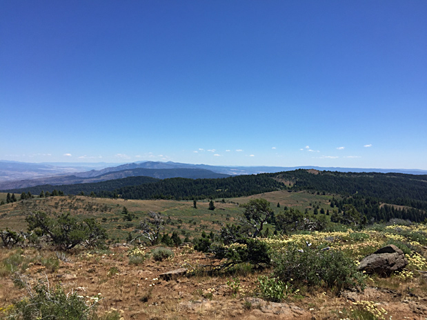
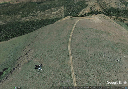
Further site study is needed: the Ochoco National Forest has perhaps designated the whole area as a Roadless Area.....I propose we lead a small expedition up there for an evening of viewing! Below is a picture from the upper reaches of Spanish Peak, looking east toward the Strawberry Mtns. The John Day Valley lies on the left edge of the picture...This picture shows Spanish Peak's vast open areas, all well over 6000 ft. and accessed via the dirt access road snaking through the picture from left to right.
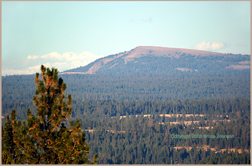
In the picture below, taken from our OSP site's main observing field, you can see a remote sweep of dry mountains to the east of OSP. We are seeing pieces of three different counties-- Crook, Wheeler, and Grant....In the very far distance, if we were just a bit higher, we'd see the 8000-9000 foot summits of the Strawberry Range, above John Day and Prarie City....
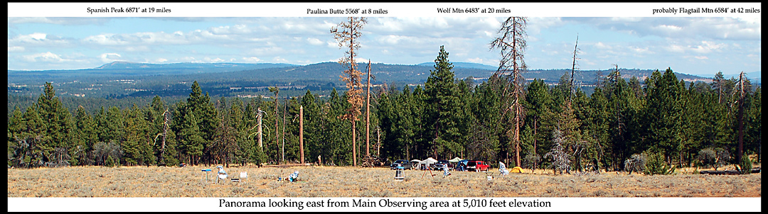
ASTRONOMY: All of the labelled summits have, or have had in the past, Fire lookout towers....Most were established in the 1920s and 30s. Some began as simple open platforms affixed to the sawed-off top of huge ponderosa pine trees, such as the 100 foot high one on top of Paulina Butte! Flagtail Mountain and Wolf Mountain are still being manned every summer (along with the one on top of Mt. Pisgah). Wolf Mountain's tower is a truly scarey climb-- at 107 feet high, it is, I think, the highest still-manned tower in Oregon.. The Wolf lookout also presides over the western edge of the 13,400 acre Black Canyon Wilderness Area......For Astronomy viewing, keep in mind that all these current and former lookout mountains have road access to their summits for possible high altitude viewing purposes! (keep in the mind, however, that some have been turned into offical NF Roadless Areas)
"Campers of All Persuasions, a Photo Essay about the Variety of Ways We Make Our Homes At The Oregon Star Party." Click for the first images from that photo essay.
Also: more on the mountains surrounding OSP-- Mt. Pisgah, Round Mountain, and others places, such as the swimming hole at Upper Falls on the North Fork of the Crooked River, only four miles from OSP at Indian Trail Springs.