 .Eliot
Glacier....................
.Eliot
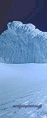
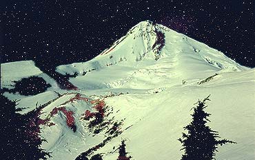
Glacier....................Dreamscape: This starry image began with an image of Mt. Hood's relatively unknown northeast face and the fearsome Eliot Glacier headwall. I spent an inspired night, solo at 6,800 feet on the windy margin of a glacier.The stars wheeled overhead in crystal perfection while the glaciers glowed softly in response. Below me was historic Cloud Cap Inn (click link and turn on your speakers for a slide show!).

Child enjoying wintertime Mt. Hood above Timberline Lodge. Click for more images of this side of Mt. Hood in winter.
Mt. Jefferson is an imposing
glacier and rock climb. Climbers seeking to test themselves on
its routes must first realize that the approach marches to its
flanks are long and strenuous-- it's not a peak like Mt. Hood
where you can drive to the timberline on two different sides of
the mountain and start climbing! From Oregon's major highways,
"Jeff" is best seen from east of the Cascade Mountains,
easily seen from Hwy 97 near Madras and Lake Billy Chinook. However,
my personal favorite side of the mountain is that seen from Highway
26, a few miles out of Sisters, headed east toward Redmond. I'm
proud of the picture I present at the left because I took it with
a cell phone held up to the eyepiece of my ten-power binoculars!
I call this image "My Favorite Side of Jeff." This picture
again recognizes the reality that the main ingredient in the creation
of thrilling pictures is IMAGINATION. (the three smaller Mt. Jeff
images are described further below)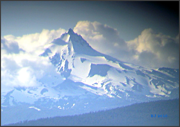
4b 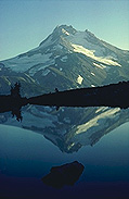 ........................5b
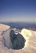 .........................6b
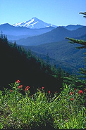
Image 4b (above left).... A secret tarn high above Jefferson Park shows the splendor of Mt. Jefferson's north side--- this small lake is a gem, but free of ice only during warmer/drier years, so many never glimpse its rare beauty. This unnamed tarn lies 65 trail miles south from Timberline Lodge along the Pacific Crest Trail... My image 4b was published as an Oregon postcard several years ago, and you may have seen it on the postcard racks somewhere in Oregon.
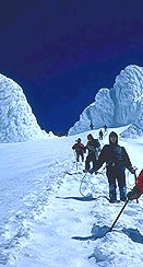
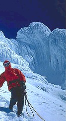
Image 5b. "A Walk on the Edge." Climber on the Whitewater Glacier of Mt. Jefferson, with Mt. Hood standing on the north horizon. Click here or on image 5b for a much closer look!
Image 6b. Mt. Jefferson's west side in June. This is a fine mountain view seldom glimpsed by most Willamette Valley residents, due to the many obstructing lower ranges. The view takes the eye up the canyon of the Mollala River, which is near Table Mountain (4,881 ft) in the BLM's little-used Table Mountain Wilderness Area.