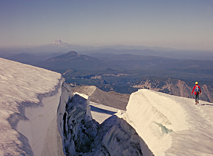
A very tired climber, on the long descent from Mt. Jefferson's summit, crosses the crevasse fields on the east side of Mt. Jefferson. He began the climb well before dawn, and now it's 5 p.m., with still a long, rugged descent before the comforts of Jefferson Park (a meadow with several lakes)...."Jeff" is Oregon's second highest peak at 10,497 ft, and the general climbers' consensus is that Mt. Jefferson is Oregon's most difficult major snow peak.
The peak is the crown jewel of the Mt. Jefferson Wilderness (made a piece of the NWPS, National Wilderness Preservation System in 1968). The Wilderness spans three National Forests, the Mt. Hood, the Willamette, and the Deschutes. Originally set aside as a small "Primitive Area" in 1930, it has been expanded repeatedly and now covers 106,978 acres. Sadly, over the past few decades, the condition and number of its trails has deteriorated due to lack of funding and damage by forest fires, especially the 2003 B&B Fire.
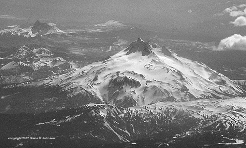
Below is an image of Mt. Jefferson's NE side taken from a jet airplane by me in late spring 2007 with a small digital camera. The Whitewater Glacier shows prominently along the east side of Mt. Jefferson. To its north can also be seen the treacherous Jefferson Park Glacier. The peak of Three-Fingered Jack is seen to the south (please click this link to my Three-Fingered Jack coverage).