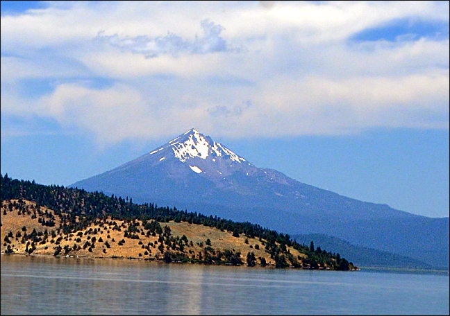
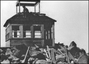
It was 1917, the United States' involvement in World War One was just beginning. Woodrow Wilson was President, there was no Internet, no TV, and even radio had yet to make its advent to the general public. Imagine it's June, the mountain you see above, nearly 10,000 feet high, has lines of pack mules hauling lumber, glass windows and much more to that summit. in the same month, in France, U.S. troops are landing for the first time, and in New York, the very first Pulitzer Prizes were being awarded. But at then-named Mt. Pitt, the goal was to build what would be the second-highest fire lookout in Oregon (the highest being the soon-abandoned lookout on the summit of Mt. Hood). (Picture above: the peak from the east, looking over Upper Klamath Lake. The trail to the summit runs on a ridge on this side of the mountain, right above and to the left of the largest snowfield). Picture below: the building of the lookout in 1917. Note the lack of any true foundation. Source: the Forest Fire Lookout Association, a National organization for the history/preservation of American fire lookouts. Here's a page specifically about Oregon: click here, page by Rex Kamstra.
But over the ensuing years, this cute wooden structure became more and more dangerous and alarming to those manning it. The main problems were the ferocious summit winds, and the monster snow and ice loads the little building was subjected to. Sometime around 1930, plus or minus a year, the old lookout was torn down and replaced with a much sturdier version on a big strong native stone foundation. Its lookout person, seen in the picture, was quite a character, and became a well-known piece of local color during the wintertimes, when he lived in Medford. But even the new building was abandoned after a few years. There were several reasons, and the full story is not known, at least within my research. The largest reason seemed to have been the gradual acknowledgement that the site itself was not very good for its basic purpose, the sighting of forest fires. The summit of McLoughlin was simply too high and was often either in or above the clouds, making lower elevation lookouts in the area much more functionally useful.
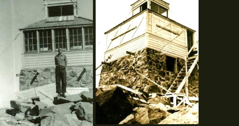
Things to note in the 1934 pictures above: picture on the left shows west side of the building, with window shutters on the ground behind the man's legs. Stout window covers such as these were in use all over the Northwest, usually put up in the Fall to protect the windows during the long periods of winter, and taken down when the lookout tower went back into action in the summer. The picture to the right shows the south and east sides, with access stairway going up the east side. Why the east side? Probably because severe winds are far more common on the western/southwestern exposures of Mt. McLoughlin. Note the numerous metal cables guying the building to the summit-- the mistakes of the 1917 building had been taken to heart!
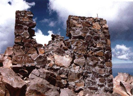
The beautiful building seen in the 1934 pictures was abandoned soon thereafter and fell into disuse and ill-repair, helped along considerably by vandalism, according to records. In 1955, official action was taken in the form of a destruction party that tore apart the wooden upper structure, except for the former floor of the building, which remained in good shape when I visited the mountaintop and slept on top of the floor in 1965. But even by 1976, all the flooring had vanished (see picture below). And by 1986 (picture above) the mortar foundation was suffering considerable decay and/or vandalism. The numerous guy cables were also no longer seen. The 1986 view above shows the east side of the former lookout. All traces of the stairway up this side were gone in 1965 and are obviously still gone in 1986. Commentary on the picture below will be found below the picture.
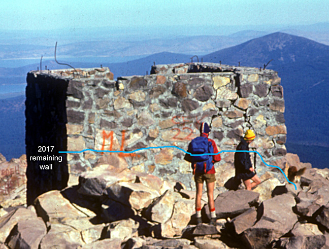
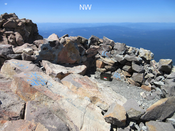
In the picture above, I show the foundation in 1976. The blue line traces what remained of the wall when we visited it in 2017. In the following picture, one can see that there is so little left of the foundation that one could mistake it for the kind of bivouac wind shelter that climbers often build out of rocks on the high peaks. The main giveaway of the truth is the gray mortar holding the rocks together. The green metal box is the Mazamas summit register for the use by climbers.
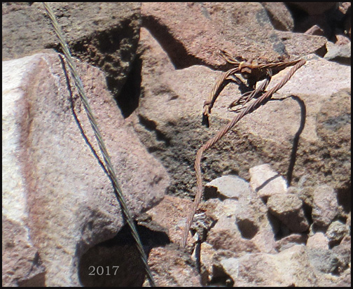
My final picture below shows a second intriquing piece of evidence that there was once upon a time something highly manmade atop this lofty Cascade Peak. I think that what we are seeing is one of the guy cables from 1917 alongside one of the guy cables from the second building, the one constructed in approx. 1930. About 12" to the right of the cables, there was an irregular, greenish melted area in the rocks about 3" across, marking a lightning strike, yet another hint about why the lookouts on Mt. McLoughlin were abandoned!