 Northwest"Northwest"
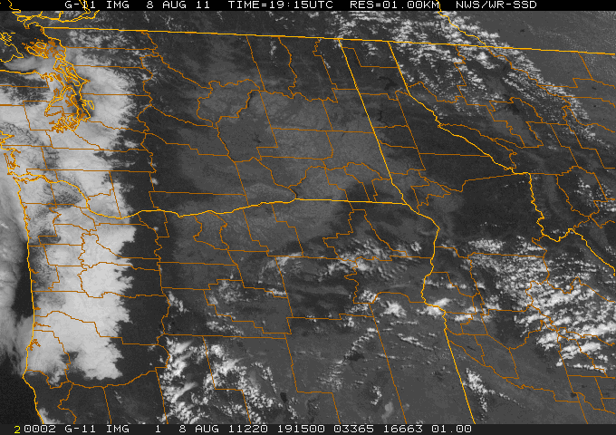
Noontime, August 8, 2011....What's typical in this warm-season scenario are the thick low clouds all over Western Oregon and Western Washington, with the Cascade Mountains rising high above the clouds into clear air; and with Southern Oregon and Eastern Washington clear, while Central and Eastern Oregon, while mostly sunny, are developing scattered cumulo-nimbus clouds which may become thunderstorms later in the afternoon over the more mountainous areas, such as the Wallowas. The temperature differences between the Northwest's climate zones are quite extreme on a day like this. For example, the Seattle-Puget Sound area at noon has overcast gray skies with temperatures in the low to mid-60s, while Medford in Southern Oregon's Rogue River Valley is in the low 80s, and the warmer spots in Eastern Oregon and Eastern Washington are generally between 85 and 90 degrees; eg. Pasco, Washington at noon is 83, with a high expected of 92! Meanwhile, Seattle is at 65, with a high expected of only 74 (and at day's end it was only 70 at Sea-Tac, because the low clouds didn't break up until around 5 p.m., and never really went away that day--- a fairly common scenario in the Puget Sound zone. In fact, even though early August historically represents the height of summertime clear, warm weather for Western Washington, the August 8th five-day forecast sadly promised more of the cool temperature and low clouds every day, including one day with "drizzle.")....Meanwhile, in Southern Oregon, Medford is promised just day after day of perfect summer weather-- clear skies, low humidities, and high temperatures in the low 90s.
Today, if you are wondering, "What's it look like over the Northwest today?" Please click this link to the source of the above image and you'll find the NOAA site for great satellite images. There are also links to satellite views all over the United States, if you want to check the skies over the town where you were born, or where your grandparents live!