More
on Recent* Icy Events in Oregon's Coldest Town
Seneca,
Oregon
Although Seneca's
former mighty Arctic cold waves may have been toned-down by global
warming (see bottom of previous page), Seneca is still capable of generating
some extreme minimums that would cause old records to fall in
any of the major U.S. cities (outside Alaska)... Click here to
skip
to a listing
of the major cold waves to hit Seneca since the Big One of 1933!
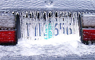
35 below zero
not cold? Oregon's most recent major arctic cold wave hit in very
late January of 1996. By old-time Seneca standards, this was only
a moderate cold wave, which set no new records on any of its five
days... Here are the figures for the 1996 cold wave: January 30,
low temperature was 8 below zero... January 31, low was 19 below
zero... February 1, low was 20 below zero... February 2, low was 35 below zero... February 3, low was
32 below zero... February 4-- the cold wave abruptly broke...(click here to see some examples
of really major cold waves in Seneca!.
1996, Ukiah...
Seneca's perennial rival had some pretty impressive cold during
the 1996 cold wave, but it was still showing its usual historic
pattern of getting colder sooner, warming up a bit sooner, and
not bottoming out quite as cold as Seneca... January 30, low was
22 below zero... January 31, low was 30 below zero... February
1, low was 31
below zero...
February 2, low was again 31 below zero... February 3, low was
26 below zero. (click for more on Ukiah)
Crane
Prarie-- click here to find out about a place even colder than Seneca
and Ukiah! (this is new research)
 Early
Season Cold-- one truly remarkable thing about cold in Seneca
is how early in the season it can occur, and this facet of Seneca's
climate doesn't appear to have warmed up in recent years, eg.
in Fall of 2002 a major cold spell began on October 12, and continued
through the end of the month.... October 12-20 had nine days in
a row with ground-freezing cold, beginning with an amazing 4 above zero on October 12, and continuing
for eight more nights with lows of 4 to 12 degrees; then a few
days of warming, followed by four more nights in the 5 to 9 degree
range.... Then, October
31 hitting 11 below zero, which was 2002's lowest recorded temperature in
Seneca.... Followed by a chilling 9 below zero on November 1....
such early season cold can also be mirrored in Springtime in Seneca,
eg. March
18th, 2002 had 4 below zero-- goodbye to all your spring bulbs at those temperatures!
Early
Season Cold-- one truly remarkable thing about cold in Seneca
is how early in the season it can occur, and this facet of Seneca's
climate doesn't appear to have warmed up in recent years, eg.
in Fall of 2002 a major cold spell began on October 12, and continued
through the end of the month.... October 12-20 had nine days in
a row with ground-freezing cold, beginning with an amazing 4 above zero on October 12, and continuing
for eight more nights with lows of 4 to 12 degrees; then a few
days of warming, followed by four more nights in the 5 to 9 degree
range.... Then, October
31 hitting 11 below zero, which was 2002's lowest recorded temperature in
Seneca.... Followed by a chilling 9 below zero on November 1....
such early season cold can also be mirrored in Springtime in Seneca,
eg. March
18th, 2002 had 4 below zero-- goodbye to all your spring bulbs at those temperatures!
The Daily
Rise and Fall of temperatures is called "Diurnal change."
Seneca ought to also be famous
for its insane
dirurnal temperature changes... Often late summer/early fall is the prime season
for these, with very clear dry air and longer nights to foster
intense radiational cooling. Example: October 7, 1964, high of
a summery 82, but a morning low of 22 degrees. The day before
had had a low of 18, with a high of 78. These daily changes of
50-60 degrees are not unusual in Seneca... And there are places
in Oregon with even more insane diurnal changes than even Seneca!
My contender for that honor goes to the little hamlet of Fremont, in the Fort Rock Valley of Central Oregon,
perhaps 60 air miles SE of Bend. A sample from the record: September
23, 1993: morning low of 10 and afternoon high a very pleasant
71--- Note: Fremont was a regular Co-op reporting station for
many decades, but more recently appears to have been replaced
by a station named "Cabin Lake," some 10 miles to the
NE; Cabin Lake is part of a small park, and my monitoring of it
so far shows it to be quite comparable to the old Fremont in terms
of climate.
Arctic
King Seneca at its Best--- REAL COLD WAVES!
1985. What a year! February
of '85 shivered with a bleak 43 below zero early in the month. This was an evil thing which
residents strove to forget during the pleasant summer which followed...
But 1985 was to have three major arctic episodes. First, the arctic
cold returned that Fall, clamping down hard by late November,
when Thanksgiving saw a six day long period that got as low as
31 below (average low was 14 below). ... but November was just
a prelude, and December 1985 was a brutally cold month for Seneca,
which suffered through a record-setting string of sub-zero nights
that lasted a full 21 days in a row, the cold finally breaking
on the 22nd day, which was New Years Day 1986-- it was a balmy
1 above zero!
1983. An arctic sneak attack!...
December 22nd, high 0, low 27 below zero. December 23rd, high a frozen 5 below zero with an achingly
bitter 48
below morning.
December 24th, Christmas Eve, high of 3 above, with low of 40 below zero. Then a heat wave came
for Christmas Day, with a high of 17 above!
1989. The
last of the cold waves of Giant Stature to hit Seneca: temperatures dipped to 48 below zero on February 6, with an average low temp of 39 below
zero for five consecutive days during the fifteen day long cold
wave! -- 1989 highlights an important facet of Seneca climate,
which is the historic prevalence of huge cold events during the
first two weeks of February. Some of Seneca's coldest-ever records
have been repeatedly set -- not in December or January-- but instead
in February, very close in time to when its all-time record low
was set (February 10, 1933, 54 degrees below zero F.). No cold
wave since 1989 has come close to the depth and length of the
1989 event, and the trend of global climate change points toward
a theory that the 21st. Century will never see the likes of 1989's
cold wave. Click
here for a chart
of the State's low temperatures from 1989 to the present to clearly
see this warming trend.
Winter 1978-79.
This winter is often
not remembered, but it was clobbered with severe arctic outbreaks
twice in one month. The first blast set in right after Christmas,
with Dec. 29th recording 34 below, then 41 below on Dec. 30th, 1978, then 35 below, then a 40 below to usher in New Years of 1979,
finishing on January
2, 1979 with 25 below. That ought to have been enough for one
winter, but late in the month another bad arctic outbreak hit
Seneca hard. January 26 at 25 below, Jan. 27 at 20 below, Jan.
28 at 29 below, Jan. 29 at 33 below, Jan. 30 at 37 below, Jan. 31 at 34 below, Feb. 1 at 29 below, Feb. 2 at 39 below, and Feb. 3 at 34 below (and then
very abrupt warming for Feb. 4th).
1972. Here was a terrible early December cold
wave of major
proportions that lasted for twelve days (remember, officially,
winter does not even begin until December 22!)...... Here are
the daily low temps for the twelve days... December 4th, low of
0. Then the cold rapidly got much worse, with daily lows as follow:
-26, -17, -15, -36,
-40,-37, -35,
-29, 5 above, -18, and -16 on December 15th.... A personal note
on this cold wave: I spent an exciting 5 days camping out in the
midst of this cold wave. I was camped near Sisters and the Metolius
River, where it was "only" 28 below zero on the coldest
night... A remembered sight from that camp will stay forever with
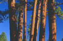
me: it's the bright sunlight streaming through ponderosa needles
with the air glittering all over with tiny suspended ice crystals!
1957. Now we're talking the snarling cold
Seneca of historic record!... January of this year featured two separate major
cold waves, together lasting nearly the entire month! On January
16th, the cold wave hit, with a low of -20.... The following four
nights had an average low of -14.... Then there were four days
of relative respite, with lows ranging from 4 to 10 above zero.....
but then major cold struck again, even harder, lasting all the
way through to the bitter end of the month. January 25 had -14.
January 26
shivered at -43. January 27 at -40. January 28 still at -37. January
29 still at -33. January
30 at -29. January 31 at -26. February 1st. saw a large incursion
of much warmer air and an astounding warm- up, with a low of 27
ABOVE! But even then the cold wasn't over, and a few days later
it was down to 18 below again, during a six day long cold snap
that lasted until the middle of February.
1955. This year featured a
very intense mid-November arctic air invasion that lasted 2 to
3 days. It produced astoundingly low readings for so early in
the season. An interesting facet of this cold wave was that it
went mainly along the western side of the Cascades in Washington,
eg. producing 1 below zero in Olympia, Washington on November
15th, but only 3 below on the east side in Yakima. (Olympia's
all-time record low is only a few degrees colder!) .... Meanwhile,
the cold did penetrate Oregon, with Redmond recording 14 below,
and Portland recording a comparatively mild 13 above. Seneca,
however, in its usual "Arctic King" manner, took this
early-season cold wave and turned it into a very impressive 31 below zero on the morning
of November 15th, 1955!
* My definition of "recent" is "since
1951." Weather records for most Eastern Oregon weather sites
got digitized only back to 1949/1950. But please recall that due
to the ill health of Mr. Howard Lohf (Seneca's long-time observer)
there are no weather records from Seneca for either 1949
or 1950. This is very unfortunate because both years had extraordinarily
cold winters which undoubtably would have broken several records.
Local reports from Seneca in my possession state firmly that it
hit 50 below zero on January 31, 1950, which, if confirmable,
would constitute the most recent time that Oregon has hit 50 below
zero! (on this date, Prineville, Oregon recorded 30 below zero,
and historical records consistently show that it is not unusual
for Seneca in a major cold wave to be 15-20 degrees colder than
Prineville).
Want to respond
to this page?
 E-mailer:
click for a direct link
Brucej@oregonphotos.com
Back to Seneca Main Page
Back
to Main Oregon Climate Page
Back
to OregonPhotos Main Page
E-mailer:
click for a direct link
Brucej@oregonphotos.com
Back to Seneca Main Page
Back
to Main Oregon Climate Page
Back
to OregonPhotos Main Page

 image
image