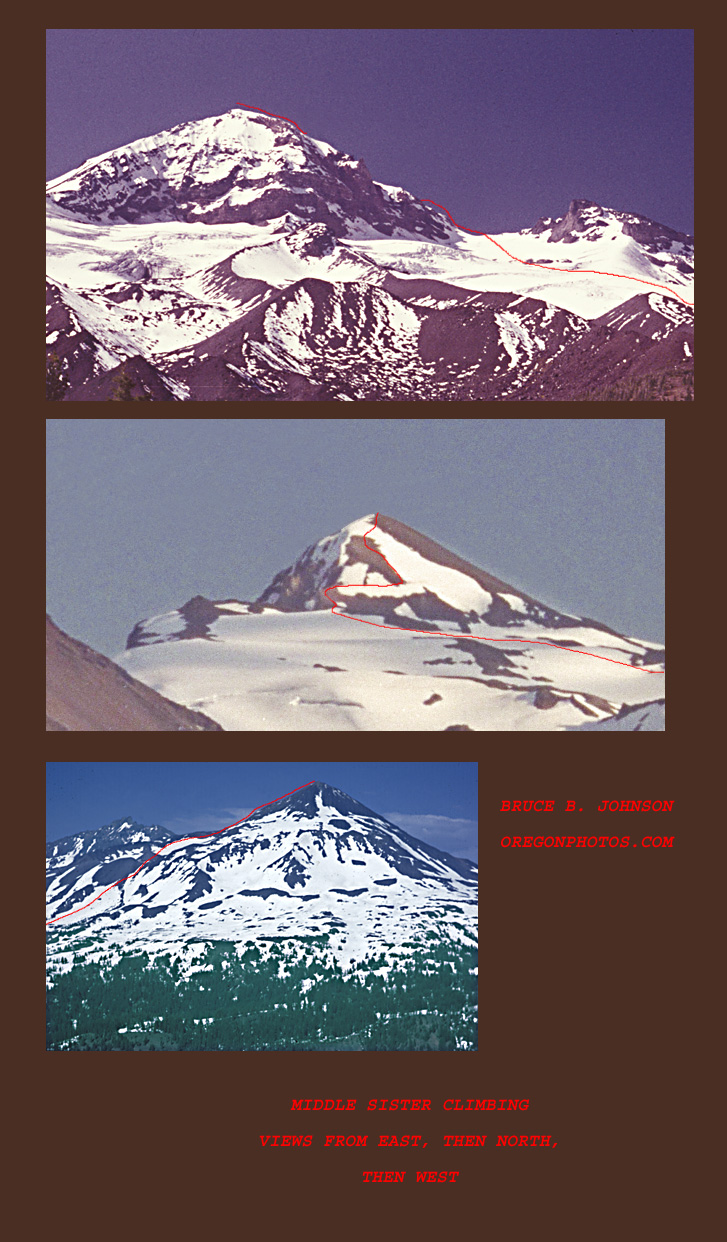
The standard Route up Middle Sister is regarded as "easy," and many very un-serious weekend climbers attempt it. The Route crosses the upper portion, or near to it, of the Collier Glacier, one of Oregon's most impressive remaining glaciers. ....As the route climbs above the col it can be quite tricky, and serious falls have occurred at this point (approx. 9,600 ft). First, as one leaves the col, they get a stomach-clutching view down the sheer east face, then they must traverse across a snowy/icy section where an unplanned slide requires very prompt self-arrest to forestall a crash into rocks below-- many who reach this section without ice axe, crampons and a rope, and skills to use them, put themselves at definite risk traversing this north-facing slope--- and put that in spades if the weather is deteriorating or darkness is setting in! (the part of the route being referred to is found in the middle photo, where the route takes the big zig to the right).
Glacier Notes: as global warming proceeds, year by year the Collier Glacier has shrunken. Currently it covers only about 200 acres. During the so-called Little Ice Age, the Collier was much larger; eg. about 1850 it was estimated to cover very nearly 600 acres. Additionally, the glacier's depth and activity level was much greater than at present. Please visit this resource for an extensive study of the glaciers of the American West, including many timelines showing historical photographs of glaciers on many peaks compared with current photographs.