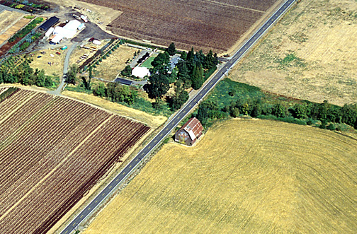

I'm not a great lover of flying, but I made a truce with my fears and went up with my brother in law to obtain this perspective on the Gribble Barn. The vast area that one sees around the Barn was only part of the original 640 acre pioneer land donation claim which the Barn presided over. Hwy 170 bisects the picture, running about north-south along the west side of the Barn. Gribble Creek, which flooded so badly in the floods of 1996 is the greenish, well-treed area visible just above (to the north) of the Barn. It flows under Hwy 170 in a culvert. Of course, in pioneer days, it was vital to both the humans and dairy cows that the Barn and home were situated so close to running water... If you were driving to Canby, you'd drive off the upper end of this picture... If you were driving to Yoder, you'd drive off the lower end of the picture. And if you drove off the left-upper corner of this picture about one mile on Gribble Road, you'd be at the Gribble Pioneer Cemetery (open to the public).
What is the "Big Picture" of the climate in the area around the Gribble Barn? Click here.